Relief Map of Canada
The Atlas of Canada's Relief Map shows Canada's relief with a colour ramp of elevation ranges. Colour tints of depth ranges show ocean water depth (bathymetry).
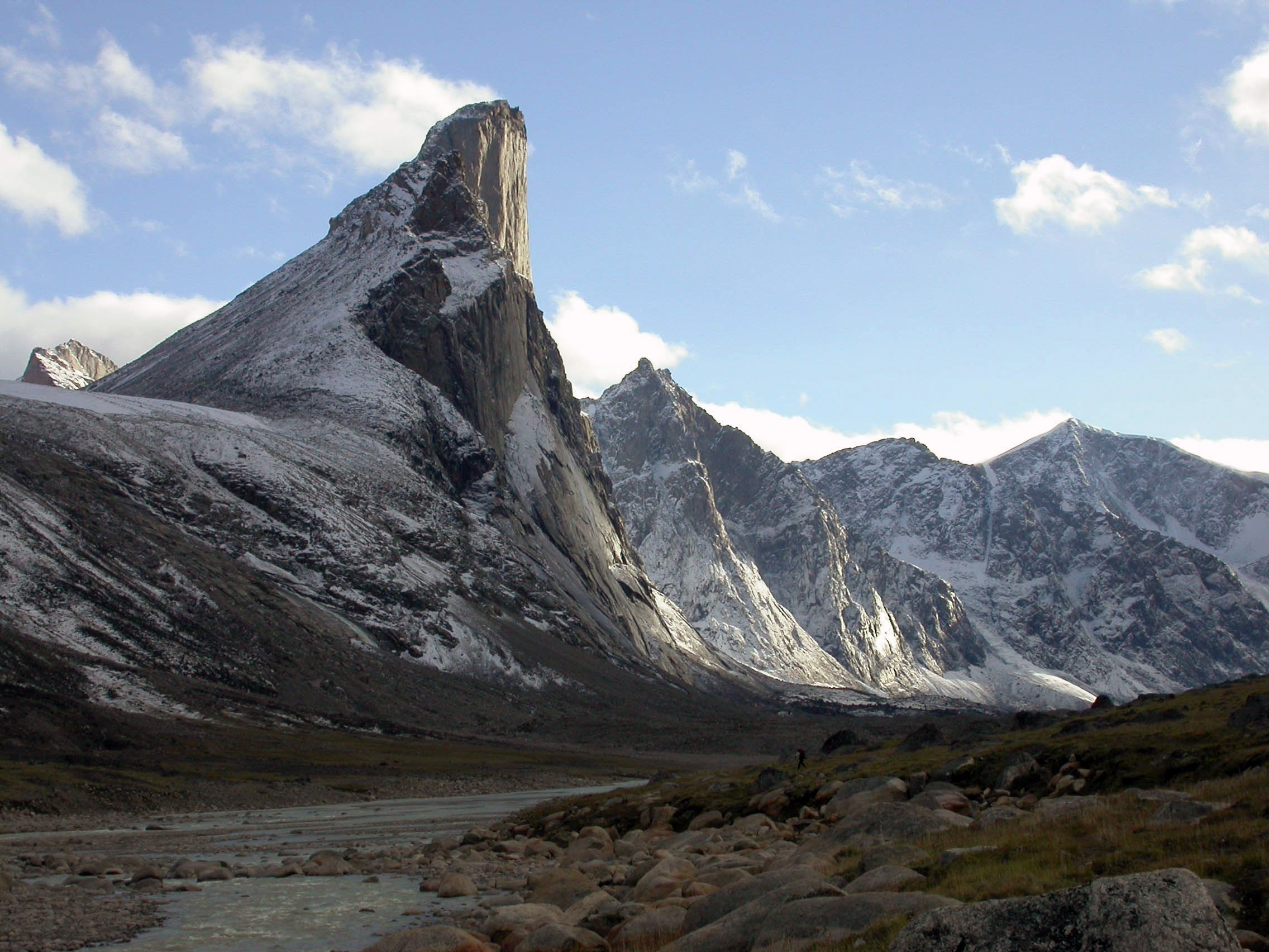
Thor Peak Auyuittuq NP - credit Parks Canada
The highest elevations are in Western Canada, in the Rocky Mountains and in Northern Canada on parts of Ellesmere and Baffin Islands. The lowest elevations exist along the coastlines and in the prairies of Central Canada.
Among the vast landscape of Canada:
- Thor Peak, located in Auyuittuq National Park on Baffin Island, Nunavut, features Earth's greatest vertical drop of 1,250 metres.
- Mount Logan, located in Kluane National Park Reserve on the southwestern boarder of Yukon, is the highest mountain in Canada at 5,959 metres.
Recognizing the difference: Terrain and Surface
This map shows the shaded 3D relief of a Digital Surface Model (DSM) (left image) and a Digital Terrain Model (DTM) (Right image). The DSM includes vegetation and buildings whereas the DTM does not.
Data Sources
Relief
Relief was derived from the merging of two raster data sets, both resampled to 804 metre pixel size:
- High Resolution Digital Elevation Model (HRDEM) - CanElevation Series
- Canadian Digital Elevation Model, 1945-2011
Bathymetry
- GEBCO Gridded Bathymetry, The International Hydrographic Organization (IHO) and the Intergovernmental Oceanographic Commission (IOC) (of UNESCO)
Hydrography
Place Names
- Canadian Geographical Names Database, Geographic Names Board of Canada.
Roads
- Road Network File 2022, Statistics Canada.
More elevation data
Access more elevation data from GEO.ca.