The Atlas of Canada - Canada’s Land Cover Interactive Map
- Canada’s Land Cover
-
 Temperate or sub-polar needleleaf forest
-
 Sub-polar taiga needleleaf forest
-
 Temperate or sub-polar broadleaf deciduous forest
-
 Mixed forest
-
 Temperate or sub-polar shrubland
-
 Temperate or sub-polar grassland
-
 Sub-polar or polar shrubland-lichen-moss
-
 Sub-polar or polar grassland-lichen-moss
-
 Sub-polar or polar barren-lichen-moss
-
 Wetland
-
 Cropland
-
 Barren land
-
 Urban and built-up
-
 Water
Water
-
 Snow and ice


Mapping Canada’s Land Coverapping Canada’s Land Cover
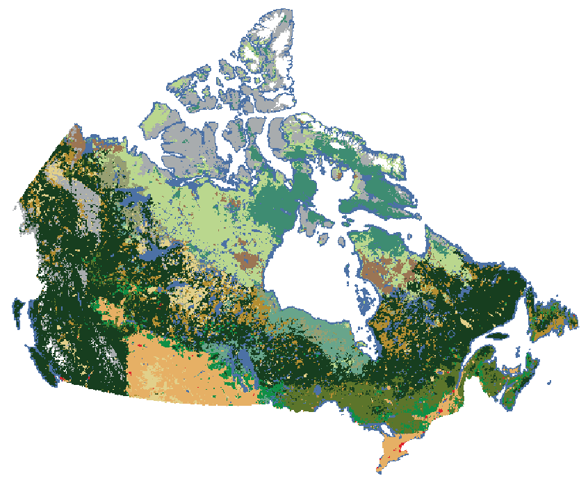
The Canada Centre for Mapping and Earth Observation (CCMEO) has used satellite imagery to create a land cover map of Canada at a resolution of 30 metres. This map is part of the 2010 Land Cover Map of North America, produced by Canada, the United States, and Mexico under the North American Land Change Monitoring System (NALCMS). The Commission for Environmental Cooperation (CEC) facilitated the project. This is the first of a series of maps, with plans for updates at least every five years.
Using remote sensing to accurately describe physical qualities of Canada is vital to understanding our natural resources. Land cover classes describe the physical surface of the ground and include the make-up of vegetation, urban infrastructure, water, and bare soil. Land cover mapping supports land-management strategies for environmental, social, and economic sustainability.
Tracking how land cover changes over time is necessary for natural resources management, policy, and planning. It is also important for a range of environmental applications, such as climate change impact monitoring, emergency response, and wildlife habitat mapping.
- Produced by the Canada Centre for Mapping and Earth Observation, Natural Resources Canada, 2019.
Related Products
- Open Maps (.tiff) - 2015 Land Cover of Canada
- Poster - 2015 Land Cover (English / French)
- This map is for illustrative purposes and neither has been prepared for, nor would be suitable for, legal, engineering, or surveying purposes.