Land Cover of Canada
Class index
Mapping Canada's Land Cover
Land cover information is necessary for a large range of environmental applications related to climate impacts and adaption, emergency response, wildlife habitat, and more.
The Canada Centre for Mapping and Earth Observation (CCMEO) has used satellite imagery to create a land cover map of Canada at a resolution of 30 metres. This map is part of the 2010, 2015, 2020 Land Cover Map series of North America, produced by Canada, the United States, and Mexico under the North American Land Change Monitoring System (NALCMS). The Commission for Environmental Cooperation (CEC) facilitated the project and Dr. Rasim Latifovic led both the scientific and product development at CCMEO.
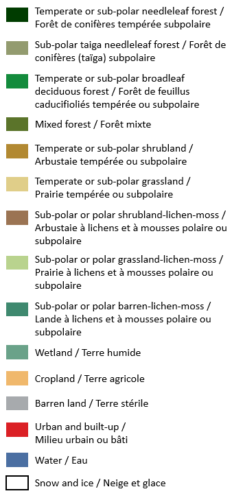
Class Index
Using remote sensing to accurately characterize land cover types in Canada is vital for better understanding of our natural resources. Land cover classes represent the physical characteristics of the ground surface, including vegetation, urban infrastructure, water bodies, and bare soil. Land cover mapping supports land-management strategies that promote environmental, social, and economic sustainability.
Tracking Changes Over Time
Tracking how land cover changes over time is necessary for natural resources management, policy, and planning. It is also important for a range of environmental applications, such as climate change impact monitoring, emergency response, and wildlife habitat mapping.
Land Cover Comparator
Land Cover Data
Discover and download land cover data
Related Data
Discover and download the map’s supporting data